5G11
Tavarnelle > Passignano > Greve gravel
40Km
Demanding
OpenRunner ID:
16920699
Start
Tavarnelle Val di Pesa
Finish
Tavarnelle Val di Pesa
Gradient
1116meters
Slope max
17.00%
Surfaces:
Asphalt
Dirt/offroad
Bicycle type
Gravel
MTB
Link alla mappa
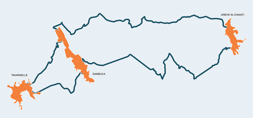
A quite short gravel path, pretty hard with its 1.116m of elevation level in only 40 kilometers. Ancient parishes like the Abbazia di San Michele Arcangelo in Passignano mark a route of great beauty through vineyards and thick forests. Beware the three main uphills that, for short stretches, reach slopes of 15/17%. But calmness and capacity of observation can help overcome any obstacle.


Stage
1
Tavarnelle Val di Pesa – Greve in Chianti
Demanding
Distance
20.40Km
Height difference
513m+
Starting from Tavarnelle Val di Pesa, after a few smooth kilometers, you meet the town of Morocco with its fifteenth-century church of Santa Maria del Carmine. The Morocco road leads to Sambuca, the lowest point of the route. After passing the Pesa river, you start to go up to reach the massive Badia a Passignano, dating back to the year 1000. The cypresses exalt its grandeur and its mighty walls, so much it looks like a castle. In the large refectory of the monastery you can admire a fresco by Domenico and Davide Ghirlandaio, depicting the Last Dinner. The road of Poggio al Vento quickly delves in a deep forest and, after a little more than 11 kilometers, meets the white road where, after a few hundred meters, in a wide area decorated with cypresses, the tabernacle of the Madonnina of Rignana gets into sight. Pay attention because at the 14th kilometer, where you enter the SP118, the climb is very challenging. A few kilometers later, you descend towards Greve following the dirt Grillaie road that, to allow a quiet entry in the ancient capital of “Agro di Florentia”, becomes paved again. Here, a stop can be useful to visit the Wine Museum and the Museum of Sacred Art.
Stage
2
Greve in Chianti – Tavarnelle Val di Pesa
Demanding
Distance
19.10Km
(39.50Km/tot.)
Height difference
603m+
(1116.00m+/tot.)
Not many kilometers later, from Greve to Tavarnelle, a long climb alternated with a long descent can allow you to recover your strength. Beautiful white road with two castles on the side, the Colognone one and the Verrazano, with its 13th century tower. The very demanding slope ends in Valigondoli, replaced by a long descent that brings back down and passes the Pesa river. In the town of Santa Maria a Macerata you encounter paved roads again, but the road maintains its solitary charm until meeting the modernity of the industrial zone. A little more than a kilometer further, you enter the Strada della Commenda dirt road, going up with major slopes. In this case the help of the Divina Provvidenza might come in handy, offering the enchanting views and a stop in the Roman parish church of San Pietro in Bossolo. You are now close to the Point situated in Tavarnelle, considered a stop along the royal road in the past and today a place of rest after the fatigue of a ride that will remain in your memory for a long time.
Tavarnelle Val di Pesa
Morrocco
Sambuca
Badia a Passignano
Greve in Chianti